


Leaving Tomorrow for Senegal
Current Position: 28 4.35 N 017 7.67 W Click to view map.
Distance sailed since last post: 0 nautical miles. View the map of our voyage track here
The internet Nightmare continues. We use 3G on the phone, with a portable wifi hostspot to the laptop. Works sometimes, for a few minutes. We go to a cafe, useless. We use the Marina wifi. Can’t even connect. So that is why you haven’t heard from us in a while. Finally, today, I put the phone’s SIM card into the Orange Airbox and, lo and behold, it works!
So, first the pressing news. We expect to be leaving tomorrow for a 850 mile sail to Dakar, Senegal. This should take us about 6 days, give or take. We will be mostly out of contact during that time, though we may send a message to Facebook through our inReach satellite device. Once there, we will have to sort out internet again, but being Africa it will probably be better than Spain.
So, what have we been up to?
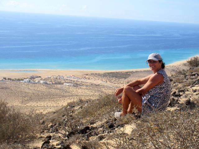
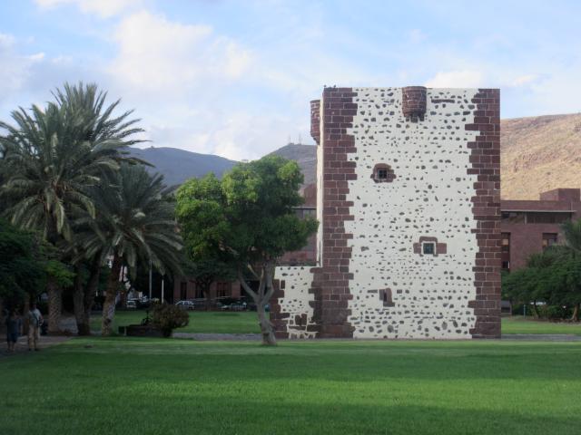
In brief, we had a great visit in Tennerife, and are now in La Gomera which is spectacular. We will put together a full post on the islands as soon as we can, but what I can say is that this Island is our favorite. If only they could sort out the internet…
Anyway, first priority is to get this message up for you, then we will work on the photos in the next post.
In the meantime you may, or may not, get a mid-ocean update from us on Facebook by using our new inReach satellite device.
Bye for now!
Cruising The Canary Islands
Current Position: 28 4.2 N 017 7.62 W Click to view map.
Distance sailed since last post: 47 nautical miles. View the map of our voyage track here
Sorry about the delay but, beter late than never, here is our retrospective account of our time in the Canary Islands.
Lanzarote
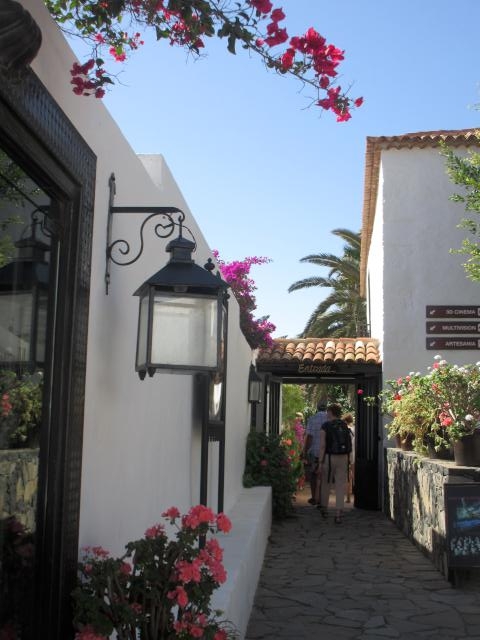
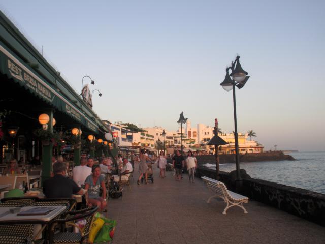
We arrived in Arrecife which was a very nice town, not just touristic but good place to shop for all your provisions. Marina Lanzarrote, nothing special, but nice with shopping, tourist information office, car rental, many restaurants, including some nice Tapa bars.
Some of the big stores, like Hiper Dino also deliver to your boat . We ended up shopping there on a Saturday afternoon and after confirming delivery with a store clerk we proceeded to do a huge shopping. After all that, once at the cashier, she told us they don’t deliver till Monday. Ok, we loaded ourselves for our walk back to the marina with all the fresh items, made another box to be kept at their refrigerator till Monday.
The next day we rented a car and visited the island.
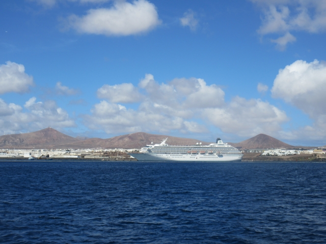
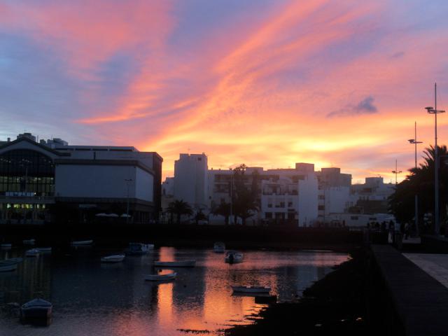
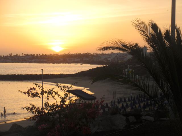
Arrecife town with nice promenade along a lagoon. Beautiful sunsets everynight and a very close walk from the marina
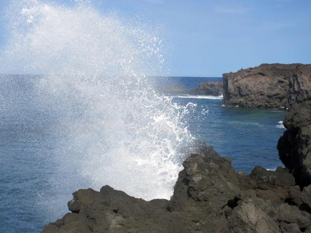
We set off from Arrecife and around the west coast
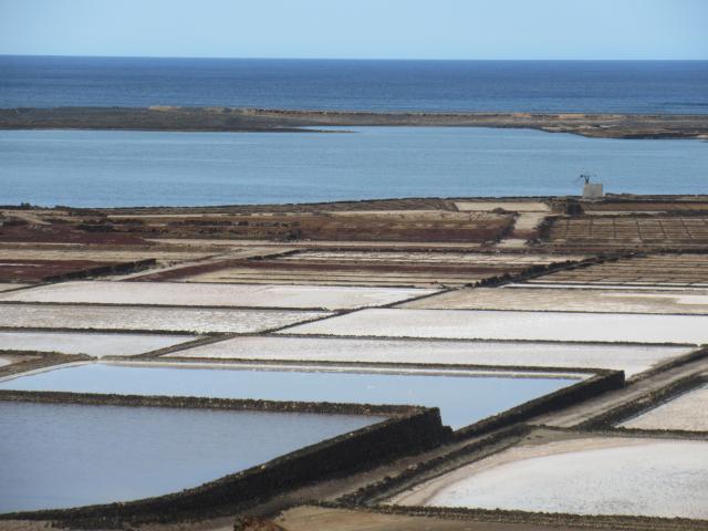
salt pans
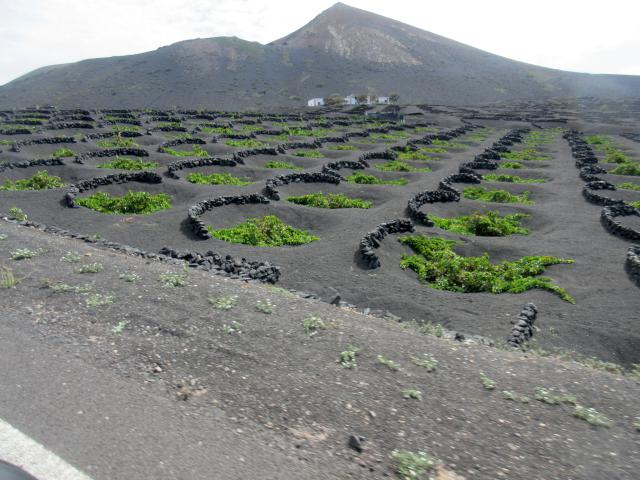
We took the wine route where the island is forever trying to grow grapes. Not easy to do when there is no rain and lots of wind!
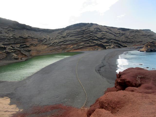
On the west coast is El Golfo a volcanic crater filled by sea water. The deep green colour is caused by algae in the water.
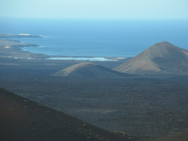
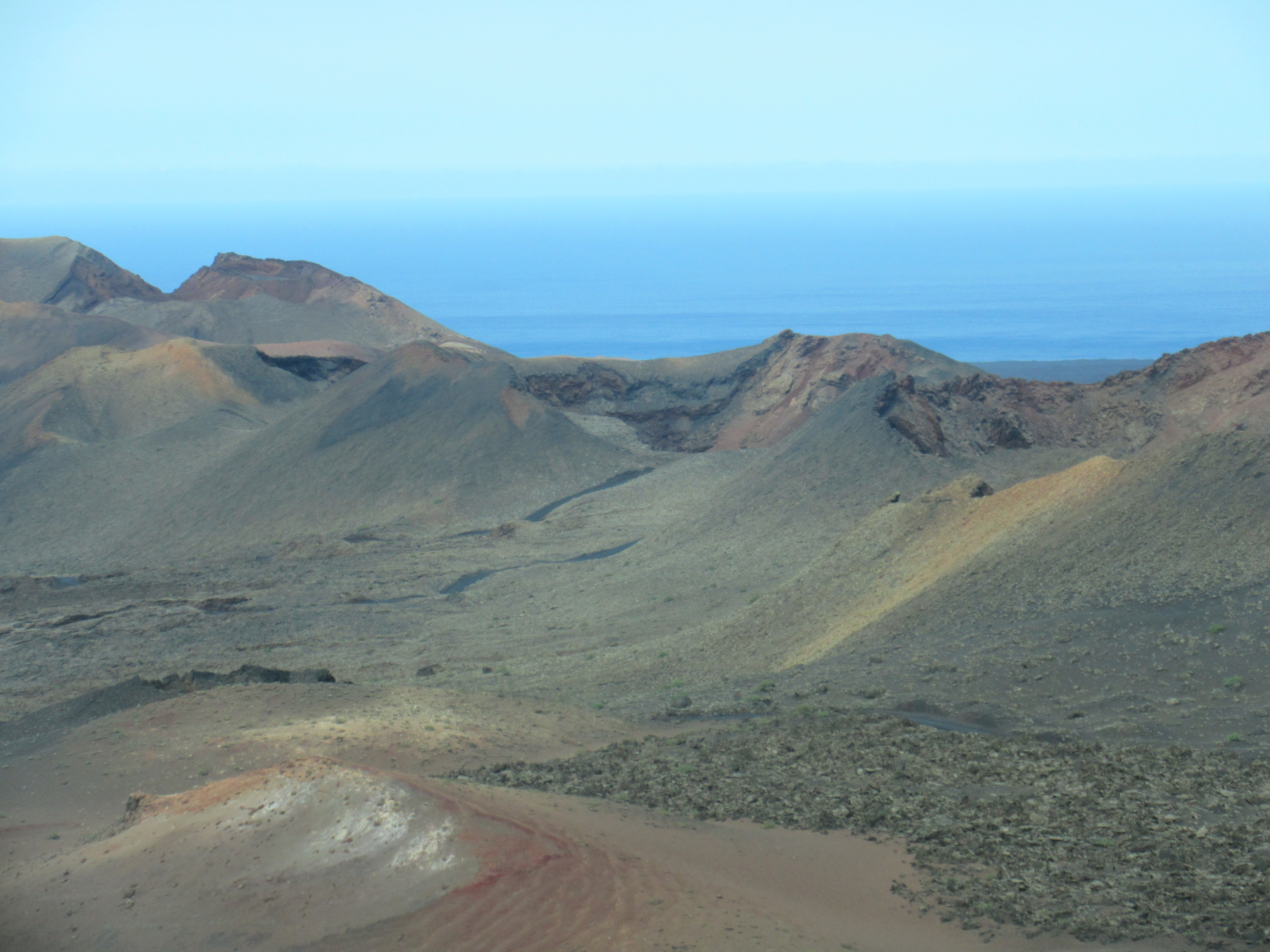
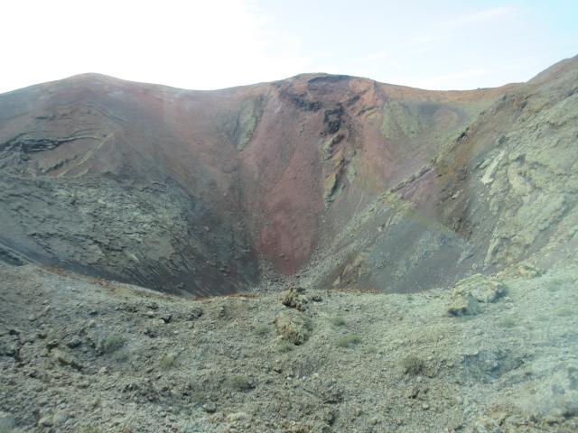
We had an amazing day out. Below is Timanfaya National park. 50 km² of Volcanic Landscape and Craters.
When you arrive up at the large and steep parking lot they have tour buses that take you on a windy and narrow road along through these amazing craters. Buses have a commentary in French, English and German.
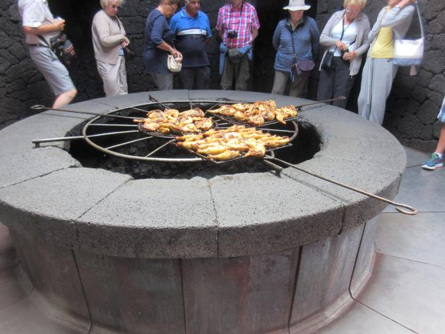
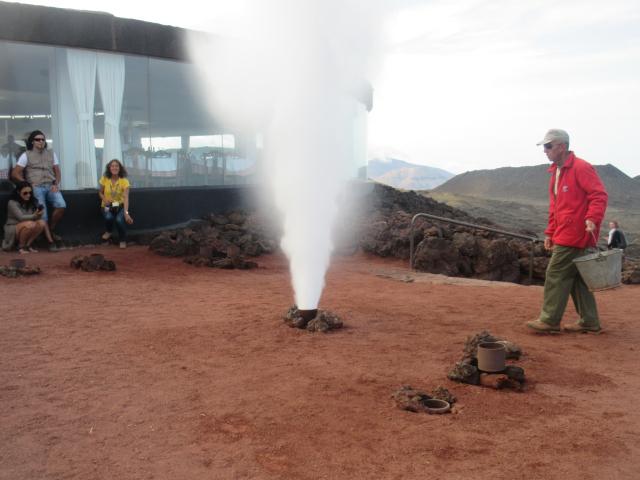
They grill with the volvanic heat from the lava
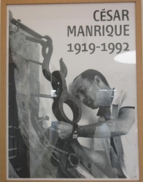
We loved the works through out the island of Cesar Manrique, who was was born in Arrecife, Lanzarrote.
He was an amazing artist,received many awards for his artistic and environment work. Lanzarrote is since 1993 a World Bisophere Reserve by UNESCO.
In 1968 he embarked in this architectural project:
A 2 story building, his home, built over 5 large natural volcanic lava caves generated in the 1730’s eruptions. Cesar Manrique Foundation is sculpted out of a volcano.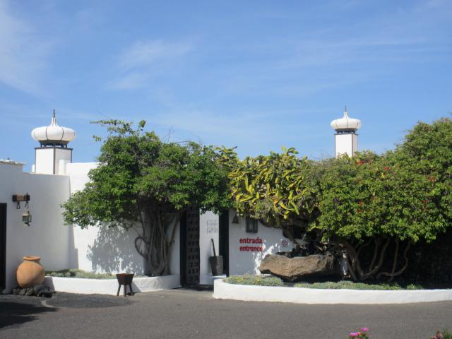
Upstairs are large rooms and open spaces with large windows taking in all the views. Some of these spaces now show some of his art on the walls and a few sculptures.
Cute spiral staircases takes you downstairs where you go through tunnels, caves burrowed in the lava as passageways to a cozy sitting room, guest room, and out the door into a beautiful recreational area. Pool, rustic oven, dance floor, all of this surrounded by beautiful flowers lava rock fountain and plant life.
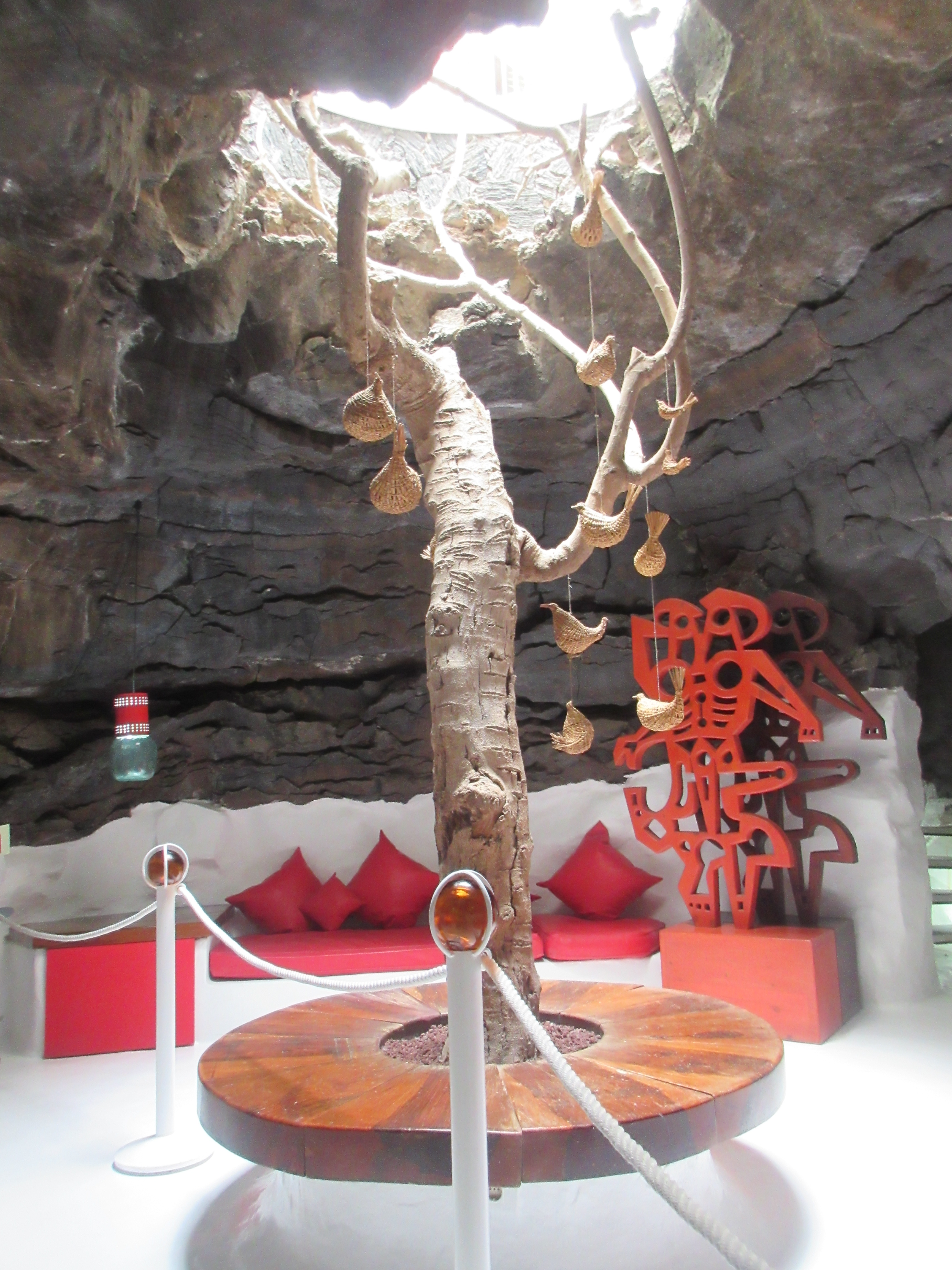
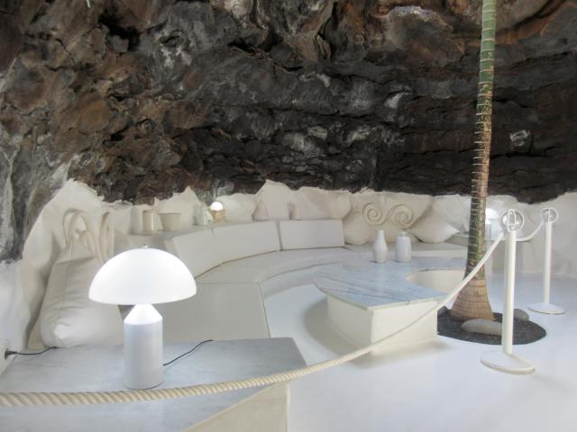
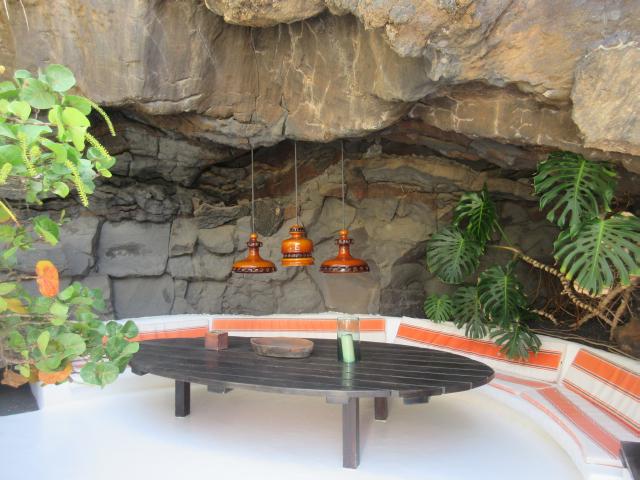
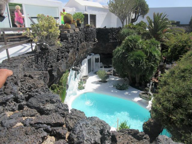
His love for Nature and building into it;s own environment shows through out. Volcano and architecture done so beautifully. It is SO beautiful, both Noel and I decided we have to have a home like this!
The garage is now the nice souvenir shop, and there is also a cafe amongst a beautiful setting.
Cesar lived in this house till 1988.
He then moved to the rural village of Haria, again surrounded by nature, but this time, he build the home in a Palm Grove he had purchased much earlier.
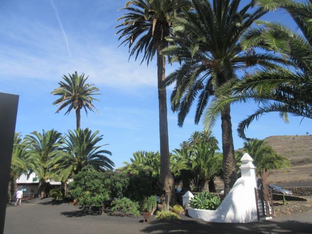
Although, the island is pretty barren, Hari is like a little oasis.
This house is different from the one on the volcano eruption, but is also beautiful. It is now a Museum.Large rooms, bathrooms all surrounded by large windows (yes, even the bathrooms) looking out into his own park like setting. A beautiful walk around the pool and the gardens and green grass, takes you to his workshop.
He lived and worked in this peaceful place till the time of his death.
He died of a car crash. His workshop still looks like he is supposed to be there and finish all his works and more….
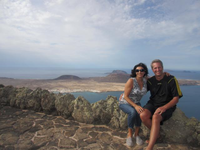
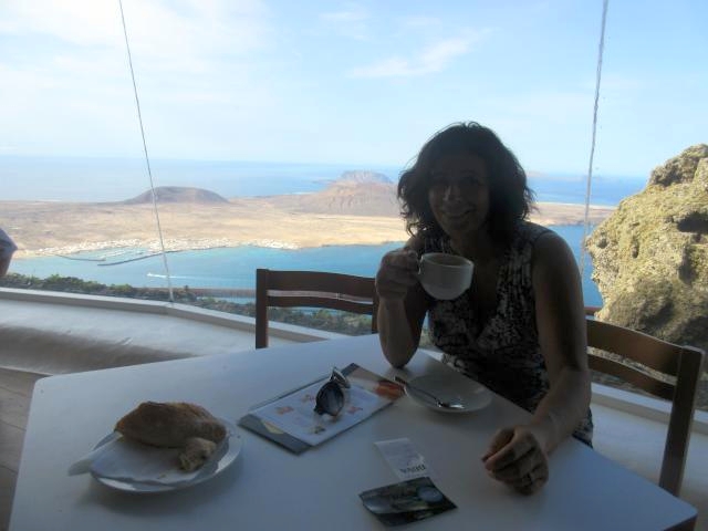
Mirador Del Rio.
Spectacular views of La Graciosa and other small islands. We did not actually sail to La Graciosa, but felt that we got a good view of it from this lookout with a Cafe/Restaurant also designed by Cesar Manrique.

Southern Lanzarotte
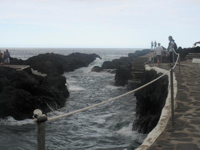
We left the marina the following morning to anchor in Arrecife Bay, short dinghy ride from the town. As we approached the bay, one nice Frenchman came to tell us that there was no anchoring in this rocky bottom and that, instead we should find a cement block with a ring. Noel snorkeled down and tied us up to it. The clear blue waters were also warm at 25 degrees and we were so happy to be swimming again!!
Lanzarrote has been home to many movies. There was an exhibition going on and outside of the museum poster of Raquel Welch on the movie papagayo that was filmed here in the 60’s
From there we sailed in a nice breeze along the coast to a good protected anchorage on Punta papagayo. Some nice beaches, mostly naturists or clothes optional.
anchorage in punta papagayo
Our next anchorage was in Playa Blanca. We anchored just outside of Marina Rubicon and took dinghy inside.
And then we were off to the next island of Fuerteventura with a nice stop at Lobos island
lagoon in Lobos island
We anchored in the beautiful turquoise waters in the little island of Lobos. Nice spot to have lunch onboard and admire the beauty but we couldn’t go ashore. There was nowhere to land or tie up the dinghy.The swell was really bad against the rocky shore. Many tourists come there from nearby islands but they get dropped off for their walk on a pier that is way too high for us, without ladder.
Fuerteventura
In Fuerteventura our first anchorage was in puerto Rosario. There is good provisions here and also buses to visit the island.
We took the bus this time to a cute colonial town of Bentacuria.
We were the only 2 people on this bus after he dropped off the third passenger sometime ago. Cute friendly senior driver was a like tour guide telling us all about the areas we were passing, including the highest and very windy roads in the Island. All of this in Spanish of course,but we could say “si si senhor, ah…muy lindo” with my Portinhol. Hard to believe this tinny town of Bentacuria was once their Capital. It is a heritage site since 1979. It has a few Religious monuments and museum, some cute cafes all in a nice setting. From there the next bus was 3 hours later, you only need an hour or so there. So we decided to hike up and over the mountain down to the next town of Antigua where buses were more frequent. There was a couple of signs we read on this route. It turns out this is a pillgramage route,every year on the day of the celebration they carry along the Saint in a procession. No wonder the path was so windy…to make it easier for everyone to climb the steep hill.
Had a nice lunch in Antigua , at the end of our hike and took the bus around the island, made one more stop at a beach town of Gran Tarajal and hopped on the bus back to the port.
This bus trip with only 2 stops, and not even a visit to whole island cost the 2 of us close to 20 euros. So if you want to visit the island and you don’t mind the driving … it is almost cheaper to rent a car and a lot more convenient. It worked for us, Sundays are often hard to find a car rental that is open, unless you are near Resorts and Turistic areas. Car rental is about 35 or 40 euros. Gas was 10 euros for the whole island of La Gomera, and 16 euros in the bigger islands
We departed Puerto del Rosario down the coast and found a nice anchorage in bahia calma.
Noel bringing in fishing lines as we aproach anchorage. Oh honey no fish, again???!!!
White sandy beaches and resorts. We enjoyed a nice walk through a park of Palm and pine trees. Good provisions here, with many resorts and apartments.
anchored in bahia calma
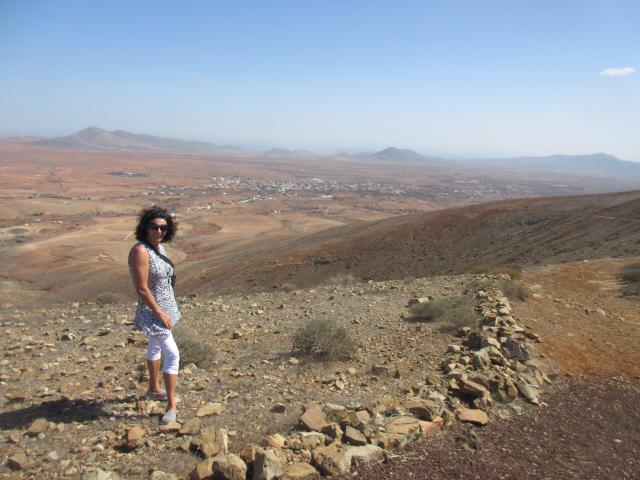
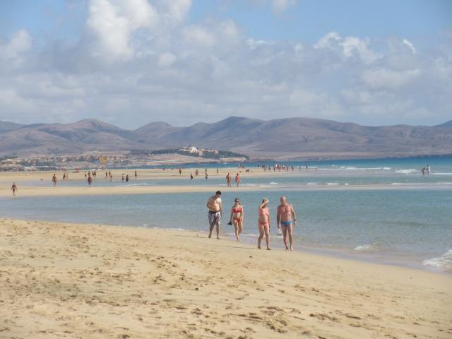
The next day we looked forward to visit some really nice beaches, virgin beaches of Fuerteventura
We had to climb a mountain to get these views, but we must keep in shape!
All these beaches are clothes optional
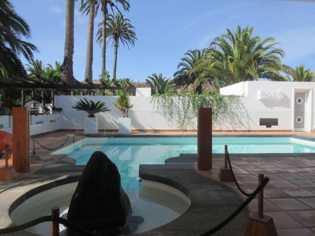
Marina Rubicon is not only surrounded by nice beaches and a long beautiful promenade, but very upscale with many beautiful shops, cafes and restaurants. There are also some bigger supermarkets for provisioning.

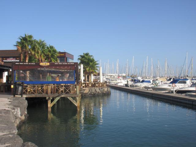
Marina Rubicon
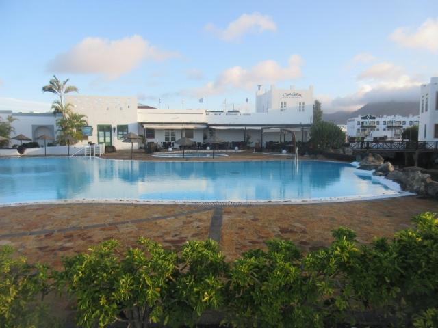
Pool area in marina Rubicon
Rain had started and we were expecting some weather coming through with southerly winds, so we went back up north to Lanzarote and called in to Marina Rubicon for a berth.
We stayed for 3 nights and got caught up online on their fast internet(for a change around here). It is a very nice marina. Shame the weather was bad and so we didn’t use the pool.
Tenerrife
We left Marina Rubicon on a night passage to Tenerrife. At 4 am we were sailing nicely at the tip of Gran Canaria, Punta Sardina, but that breeze didn’t last long, we motored for awhile after that. Bright lights of Tenerrife ahead.
We were headed to Puerto Radazul where we had booked a berth. The only place around that had space.
Wow, it was quite a sight arriving here with all these apartments built right into the steep rocky mountain
We tied up right on starboard along the wall across from the office. Not much English speaking but very friendly.
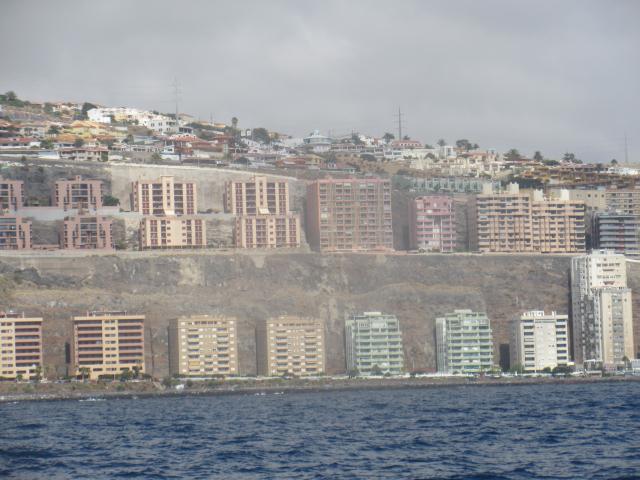
puerto radazul entrance is below the last building on the right
The next day we went up the coast passed Santa Cruz de Tenerife
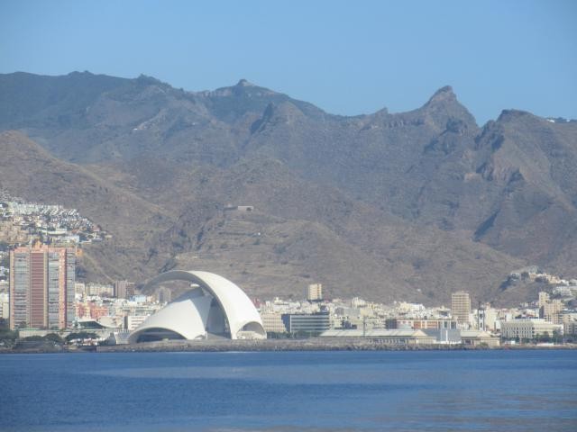
Santa Cruz
Beautiful spot, anchored in in rippled black sandy bottom in Playa das Teresitas just North of Santa Cruz. Turquise waters and great snorkeing!
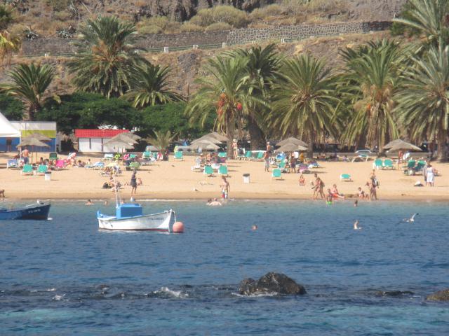
 The beautiful and only white sandy beach in the island, backed by palm trees and the cute fishing village of San Andres. The reason the sand is so beautiful is tht it is imported from the Sahara! Cheat!
We headed down south, next anchorage at puerto Guimar. It was a rolly night! No wind, but the swells came in overnight.
Nice sail to Bahia de Abona. Another rocky night but a beautiful spot. Black sandy bottom, a lava flow just behind our boat. Great snorkeling again. Tried to rent a car here, but nothing available. Small village, very touristic, popular with the Spanish locals.
After a bit of a walk and almost 200 steps later we arrived at the main highway to catch a bus. Visited the beach Resort Los Christianos, full of English breakfasts for 3 euros, and Sunday roast dinner and yorkshire pudding for 6 euros. We enjoyed a yummy Chinese dinner a block away from the crowds!
We bused from there to the airport and picked up a car there for the next day so we could visit the island.
Pico del Teide National Parc
Teide is a volcano that is still active now.
It is topped with light colored cone with a crater about 80 m in diameter
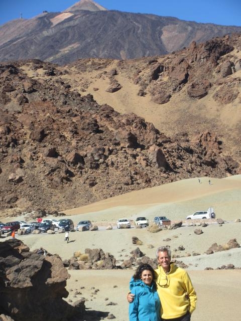
The day we visited was very windy so the telepheric was shut down, so no visit to the top.
It at 3700m altitude being the highest point in Spain and the Atlantic archipelago.
The last erruption was in 1798. For 3 months it was throwing out a huge amount of lava covering an immense area we drove thruogh for awhile.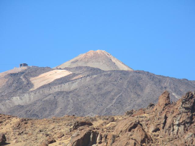
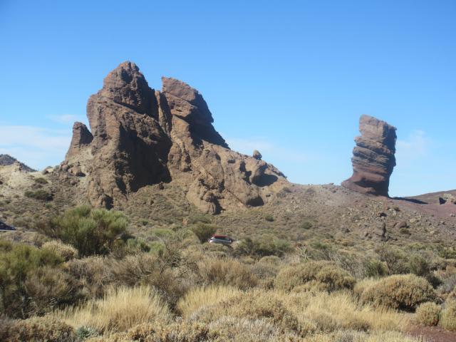
Going up toEl Tide. Views from windy road and pine forests
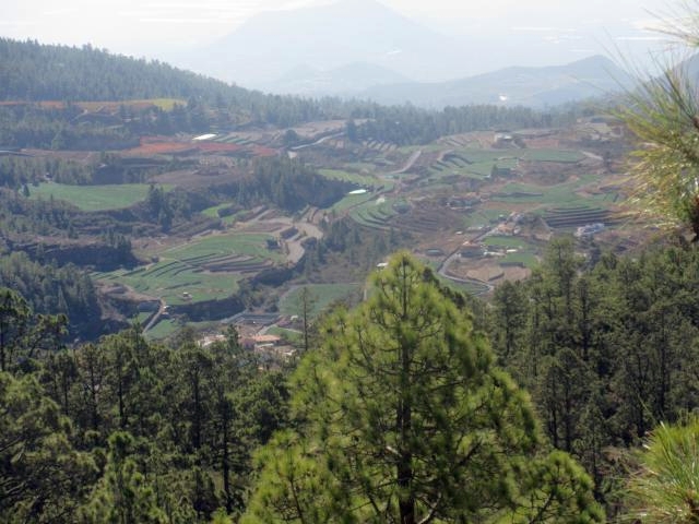
Coming back from El Tide we took the Orotava valley route on the other side
Windy and steep hill coming down to sea level again with beautiful views and some fotos before the popular cloud of mist took over.
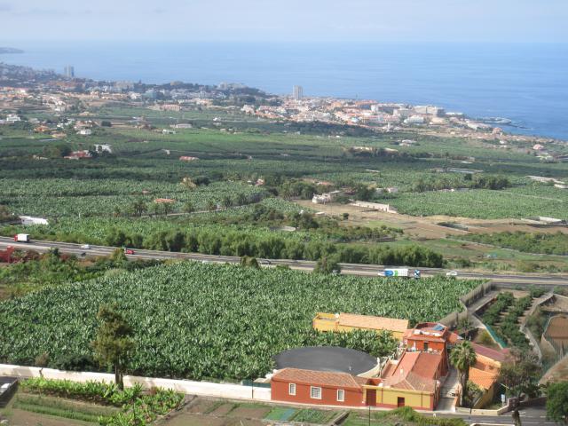
view of the banana plantations and Los cristianos and puerto de la cruz resorts
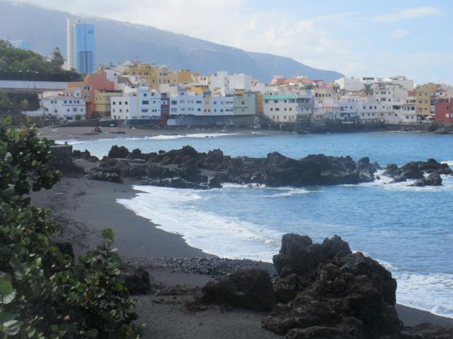
We made a stop in Puerto de Santa Cruz. The old town is really cute with some nice buildings and some Churches and squares.The traffic was bad and we could not find parking there.

Found parking a little ways from the old town near the beaches. Really nice town with many villas and parcs. At one of the Resorts the gardener was mowing the lawn. Ohh that nice smell of freshly mowed grass!
Visited the nearby town en route to see the 1000 year old Drago tree
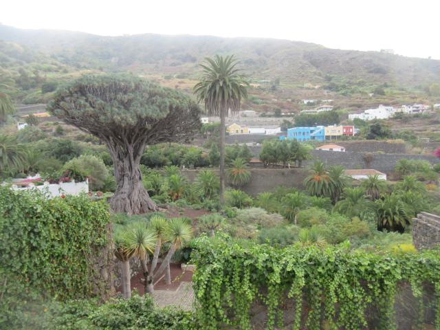
Drago tree
Guirincho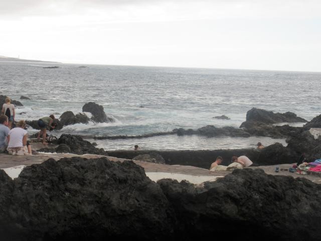

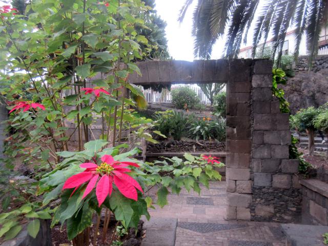
These poinsettia really steal the show! I love it
Masca ravines
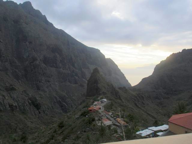
the sunset over Lagomera island afar
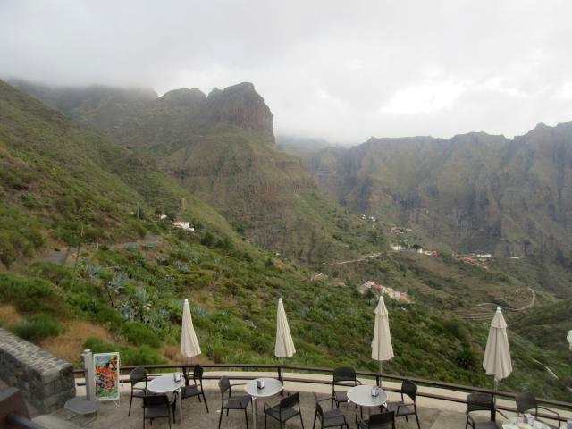
Ohhh my Goodness..As if we had not had enough of beautiful scenery hills and bends, the best was still waiting for us on the last leg home to LifePart2.
This road through Masca is just incredible. Not many chances to stop and take photos either. Narrow road and quite a bit of traffic probably all trying to get home before it got dark.
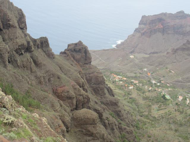
And so, on to La Gomera…
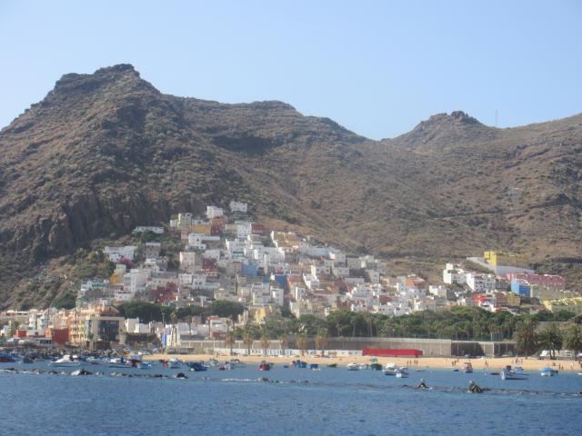
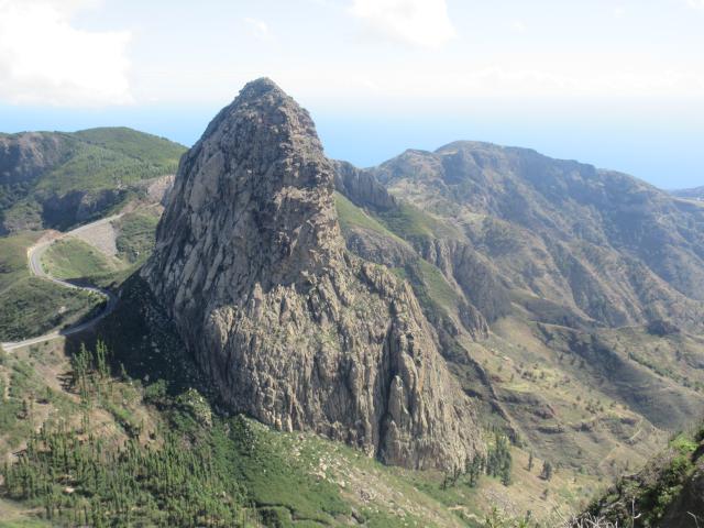
La Gomera
We were getting tired of the rolly anchorages through the islands. Called Marina La Gomera for a berth, they said they were full but to check the next day.
So we anchored just a mile south of the Marina in Playa de la Guancha and dinghy to the marina. They told us they would have a berth for us the next day, but actually we really enjoyed our anchorage, however we booked in for one last night so we could fill with diesel and water before setting off to our long passage to Senegal.
Our anchorage was calm, clear waters and a black peble beach all to ourselves for a few nights. One night, one boat joined us and left next morning and another night 2 guys set up a tent for the and enjoyed the beach and the clear waters au naturel!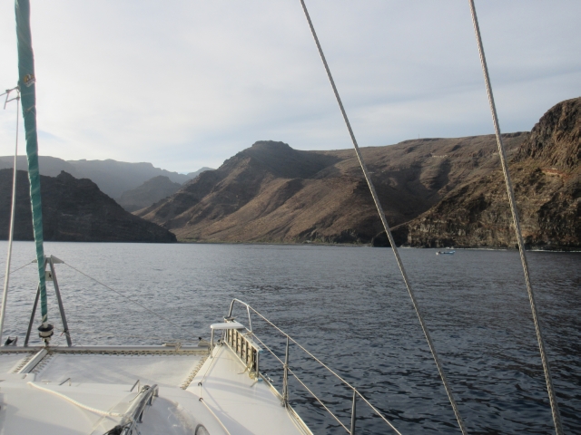
We spent a night in Playa del Cabrito,a mile or so further down from Playa de la Guancha, which was nice too, with a few cottages and some tourists, accessible by boat only.
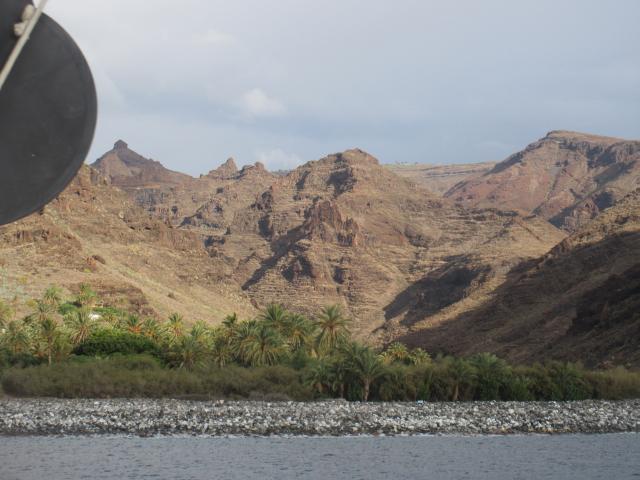
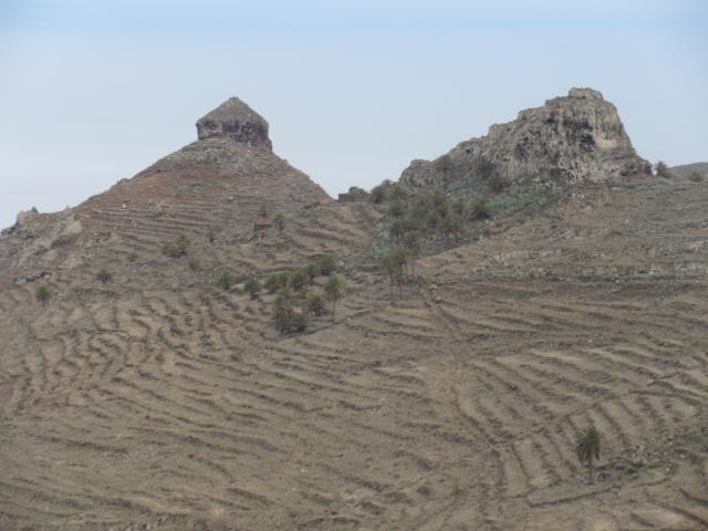
When you approach it looks barren but as you get in to the valleys it is beautiful and green and luscious!
Wow we so enjoyed La Gomera very much
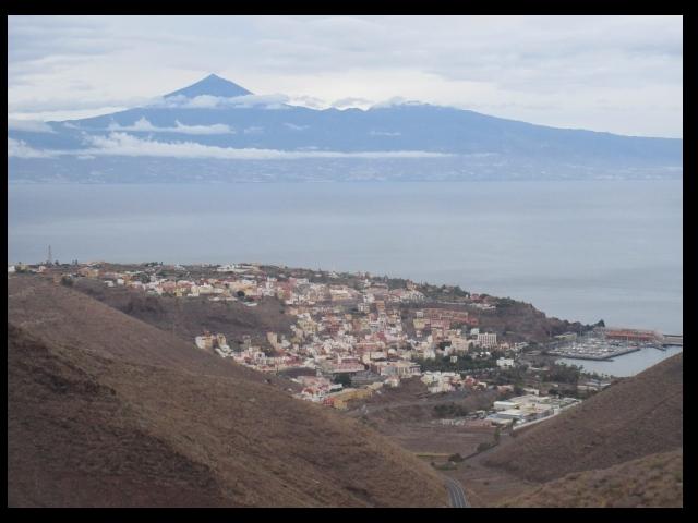
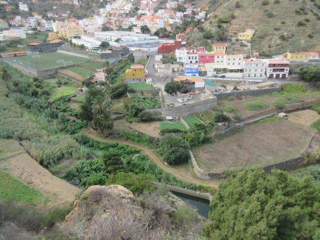
The town of San Sebastian, marina La gomera and Tenerife’s El Tide far away
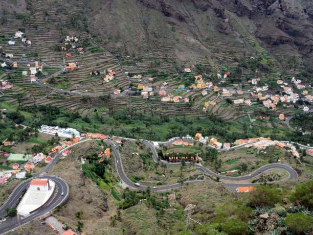
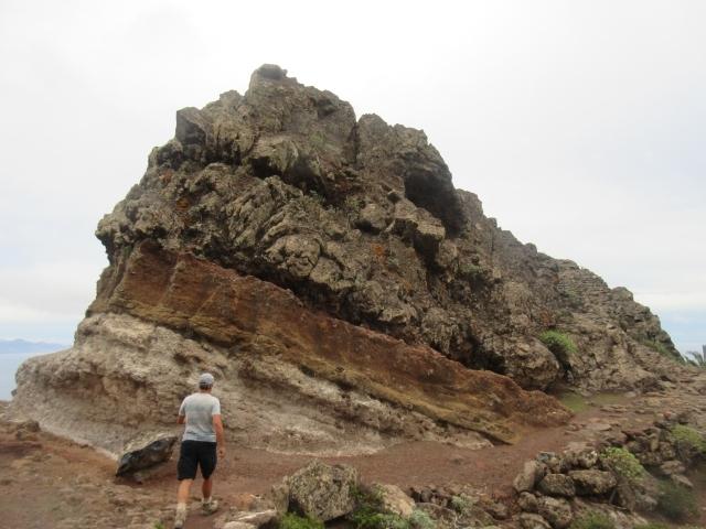
Valle Gran Rei ,nice walks – and these ‘hairpin bends’ so much fun
On this street we visited the house of Cristopher Columbus. It was here at this Port that he provisioned and set off, on his adventure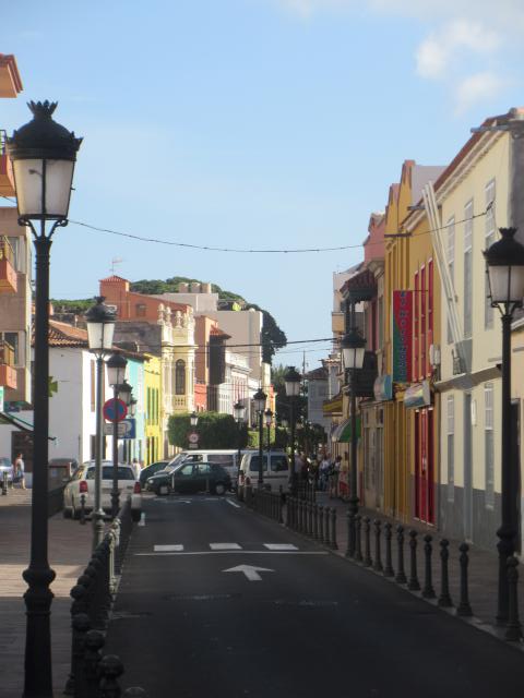
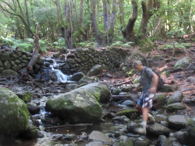
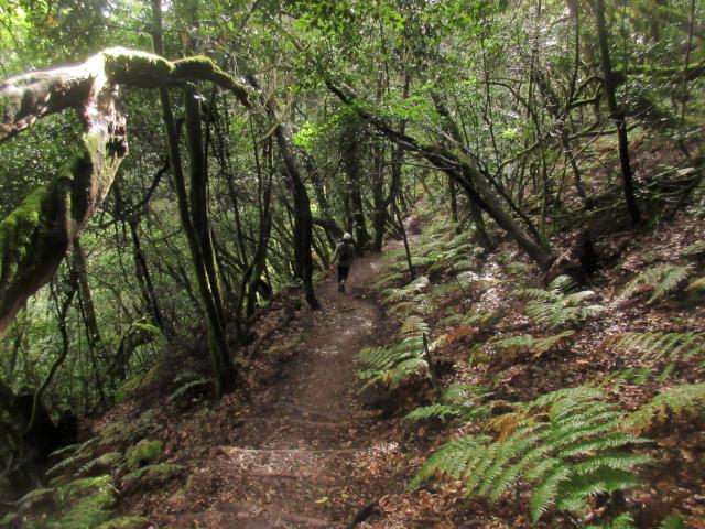
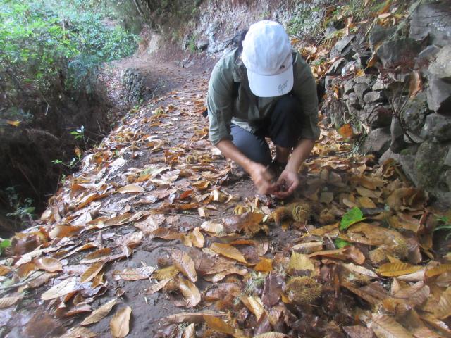
A nice hike with a bonus! I was delighted to find some chestnuts. I really enjoyed them during my lonely night passages to Senegal. Yummy confort food.
We rented a car for the day. it it was amazing scenery. This island is a hikers paradise, so many diferent walks, hikes of all levels and lengths, also very well marked. When we dropped off our rental car and we told the guys we were catching a bus up the next morning to do some hiking he offered to give us a ride, he was going out that way. We did 17 km. The scenery was just amazing, everywhere!
And so that brought a close to our Canary Islands visit. Next was a 6 day sail to Senegal.
Arrived in Tenerife!
Current Position: 28 24.04 N 016 19.39 W Click to view map.
Distance sailed since last post: 135 nautical miles. View the map of our voyage track here
Once again we had everything. First a fresh breeze that had us romping along at 7kts.
Then, as soon as it was dark, the wind disappeared. So it was motoring through the night and through the next morning.
Then, as suddenly as it had vanished, it was back again, and for the final four hours we had 19kts of wind again, and were again stomping along at 7-8kts.
So, here we are in Tenerife. Not sure what the plan is. We were hoping to get some propane gas bottles filled, but it seems that can’t be done until Monday, at the other end of the island. And then Tuesday is a holiday here.
Anyway, first priority is a shower, then a beer, then some food, and then some sleep.
Hmm, so far managed the first two. Then a bus ride, long walk around Santa Cruz to ask about propane bottles. No luck so far, but we did spot an all you-can-eat sushi restaurant. So that is the next stop. After beer two in this cafe while I send this update.
Leaving Lanzarote for Tenerife
Current Position: 28 51.38 N 013 48.91 W Click to view map.
Distance sailed since last post: 16 nautical miles. View the map of our voyage track here
The wind has been acting up the last few days. For three days we had big waves coming from the north, and strong winds coming from the south. So where does one go with those conditions?
In a marina is the answer. So that is where we have been for the past three days, while the skies were grey and the rain – yes rain in Lanzarote – was heavy. But Marina Rubicon has great internet, which is a rare treat, so we caught up on a lot of online stuff.
Today the sun is shining and the wind is still from the south, but due to go light and then round in circles the next few days. So we are jumping on this opportunity to sail to Tenerife.
Because of the south winds it would be harder to go to Gran Canaria which, in any case, is pretty busy this month, so we will just skip over that for now and see if we can find an anchorage in Tenerife.
The passage is overnight, so we will be out of touch until tomorrow!
Highlights of Morocco
Current Position: 31 37.77 N 007 58.87 W Click to view map.
Wow..it has been a busy 3 weeks..
Since we left Lisbon on the 25th of September, we have done 2 long crossings, visited Morroco and one of the Cannary islands.
We enjoyed morroco very much. People were just so warm and friendly. Taking the local train was always a great experience with the locals. They quickly welcomed us into their country and loved chatting with us to practice their English. Surprisingly, not as many people speak French as expected, as it is supposedly their second language. Going shopping was always a fun experience with us speaking French and them speaking Arabic.
On one train ride we were chatting with a pretty 21 year old girl, when she told us that the lady sitting next to her had just asked her if she would marry her son! It seems that arranged marriages are still pretty common, although usually with the agreement of the young couple.
We managed to visit 7 of their 9 UNESCO sites in Morroco. All by train and buses, sometimes taxi from the station to the destination in town. It was very inexpensive as well.
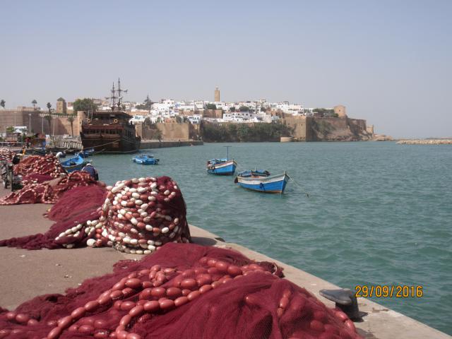
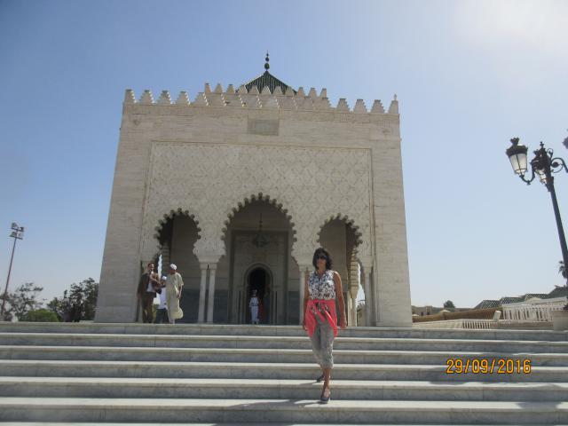
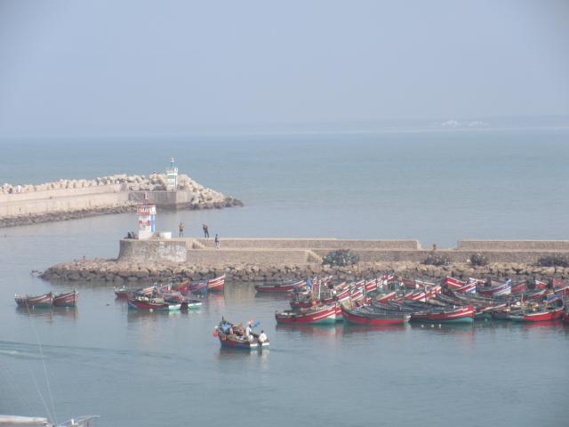
Rabat
This is the capital of the country, and is certainly the most modern of the cities, with the exception, perhaps, of Casablanca.
We arrived up the river, past the fishing boats and the old Kasbah, before turning left into the marina.
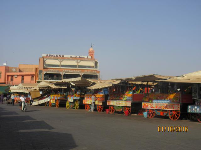
Marrakesh
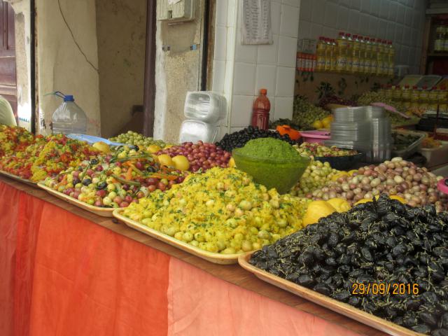
2 days after arriving in Morocco, we took the train to Marrakesh. This is most famous for its Medina and, in particular, the large square, Jemaa El Fna, which is supposed to be the most beautiful square in the world. Well, um, not so sure about that. In terms of architecture, the square has little, though the rest of Marrakes certainly has some beautiful mosques, gardens and palaces. In terms of street entertainment, again, it cannot match the street performers that we have seen in Covent Garden, Syracuse, Seville, Albufeira and many other places. But it does have buzz. And lots of places serving food and delicious freshly squeezed fruit juices served from the stalls shown below.
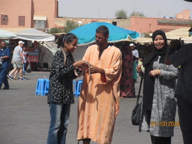
And snake charmers. We managed to sneak this photo, as they do all they can to prevent you taking a photo unless you pay. However, we did not see them actually charming snakes. Mostly the snakes were lying coiled up on the ground. By early evening they are all gone.
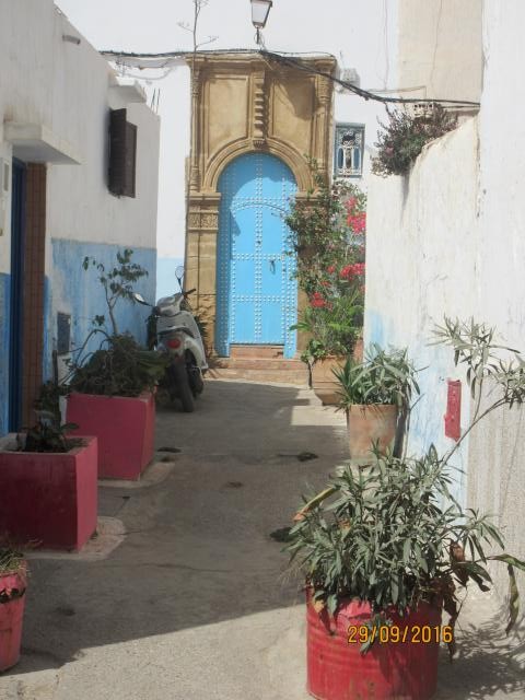
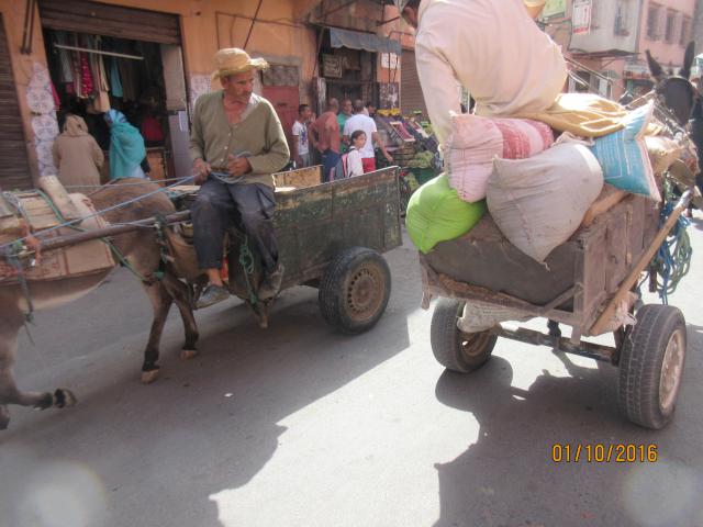
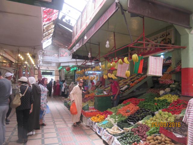
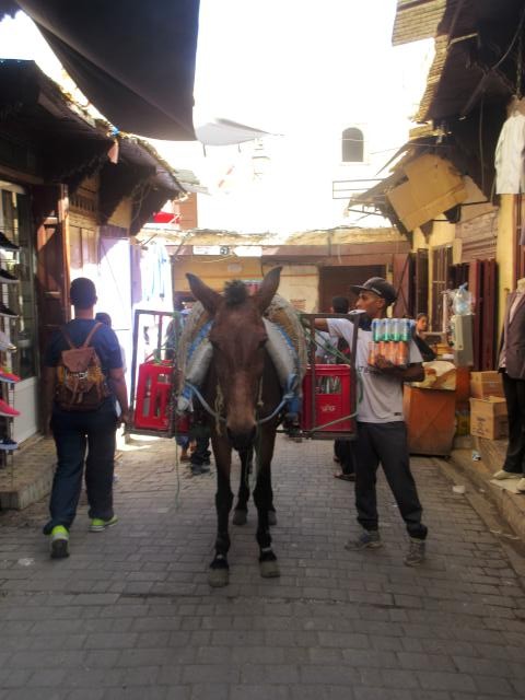
Like most of these arab medinas, the streets are very narrow and crowded, and you may have to share the road with the donkeys bringing produce to the stalls. They don’t hassle you as much here as in Tunisia or Turkey but, be warned, the carpet sellers are still out in force! The city feels pretty safe, but if they can rip you off on a deal, they will do so.
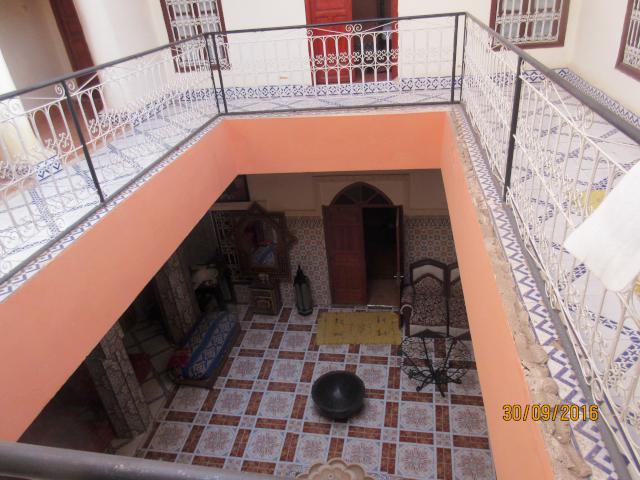
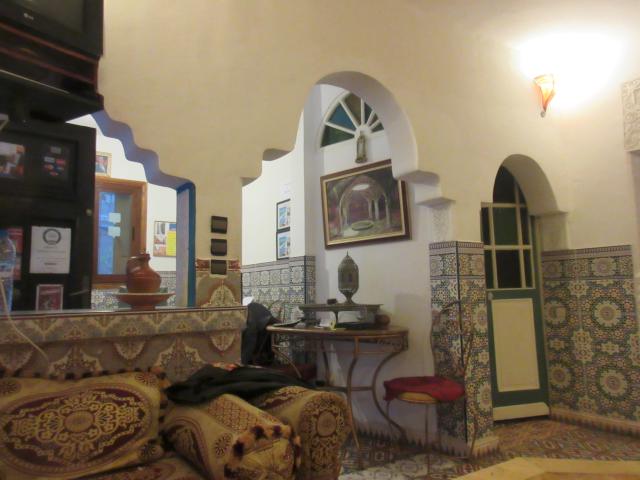
In all the cities we chose to stay in hostels that were housed in riads. A riad is a traditional house that has a central courtyard with the roof open to the elements. Usually there is a fountain or similar in the middle.
Atlas Mountains
One bonus of staying in hostels is that they are great for organizing cheap tours. We took a three-day trip to the Atlas mountains and the Sahara desert.
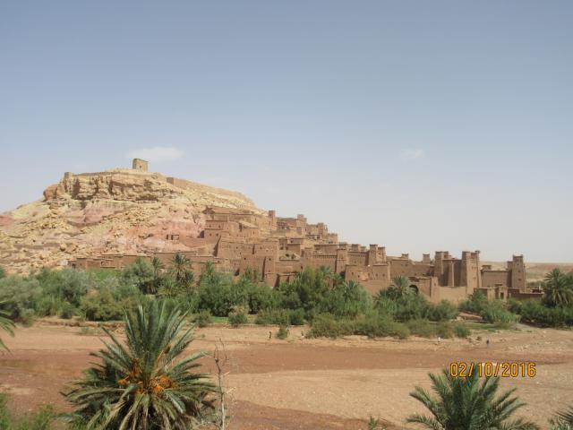
Ait Ben Haddou is a UNESCO site that has been the filming location for dozens of movies, such as Gladiator and even James Bond. Our guide says he has been in several as an extra. It seems to provide some additional income for the locals! Just as well, since every two years they have to fix up their mud-brick houses that deteriorate in the rain.
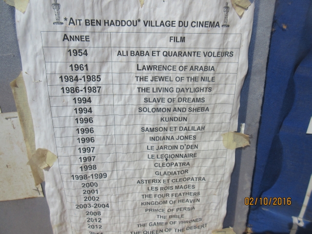
Movies filmed at Ait Ben Haddou
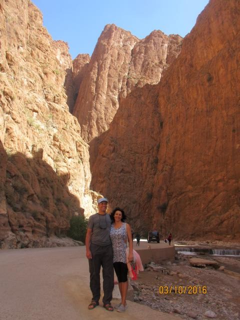
Nearby is the Gorge of Todra, which is worth a couple of hours visit. It has a 300 m canyon in the Dades valley.
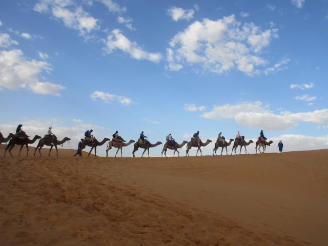
The ‘road of the thousand Kasbahs’ took us to the Erg Chebbi sand dunes, where yet more films were made, and where our camels awaited us for a sunset cruise.
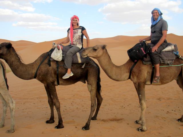
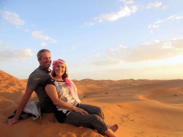
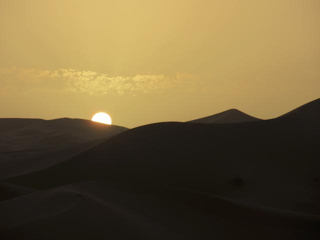
And an early morning sunrise.
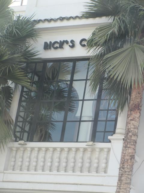
Casablanca
Casablanca has to things going for it: First is Rick’s Cafe, famous at the location for the movie. But I doubt that Sam is still playing there.
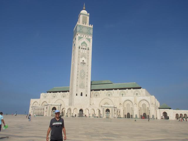
And then there is the world’s largest mosque outside of Mecca. Room for 25,000 worshipers.
We didn’t get to go inside as there are restricted viewing times.
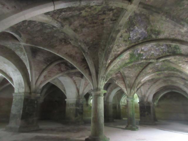
Portuguese City of Mazagan – in El Jedida
A tiny port and fortress that was built by the Portuguese in 16th century as a major trading center. Quite interesting. Once again, we stayed in a Riad, where they offered both beer and wine on the rooftop terrace!


Only the cistern and a church (which is now a theater and was being renovated and so could not be seen) are the notable sights. Plus, of course, a Portuguese cafe and restaurant. But no one speaking Portuguese any more.
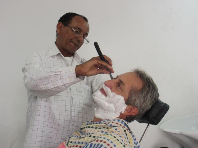
So, having forgotten his razor, Noel was in desperate need of a shave.
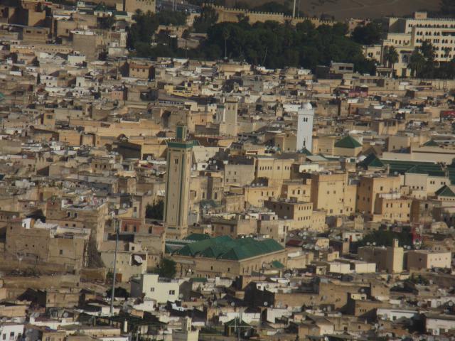
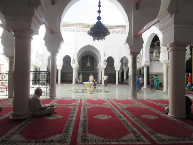
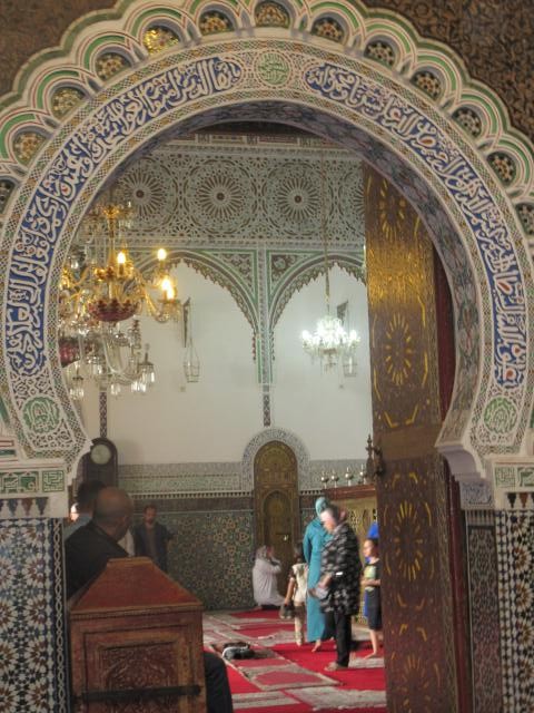
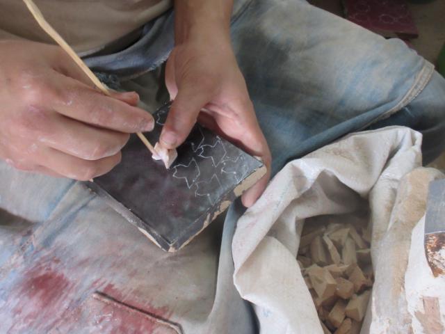
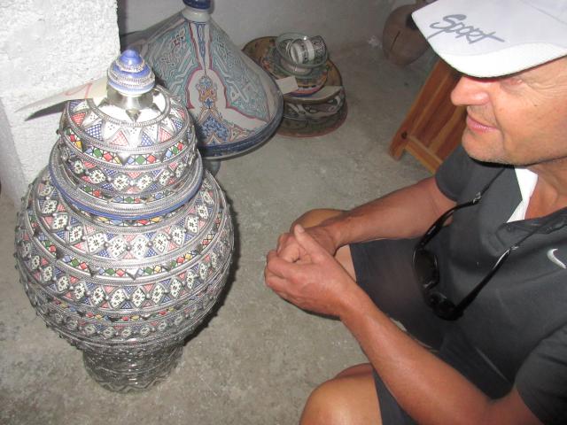
Fez
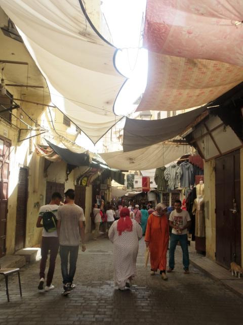
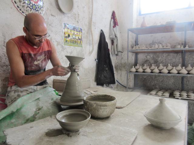
The smells, the chaos and the confusion of Fez. One huge medina in which one definitely gets lost.
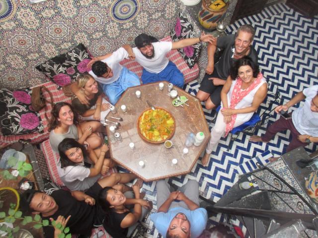
Again we stayed in a small Riad, where we met with other travellers – from Australia, England, Mexico and Mongolia! The Riad owner made a large dish of couscous for lunch.
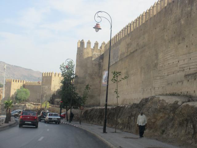
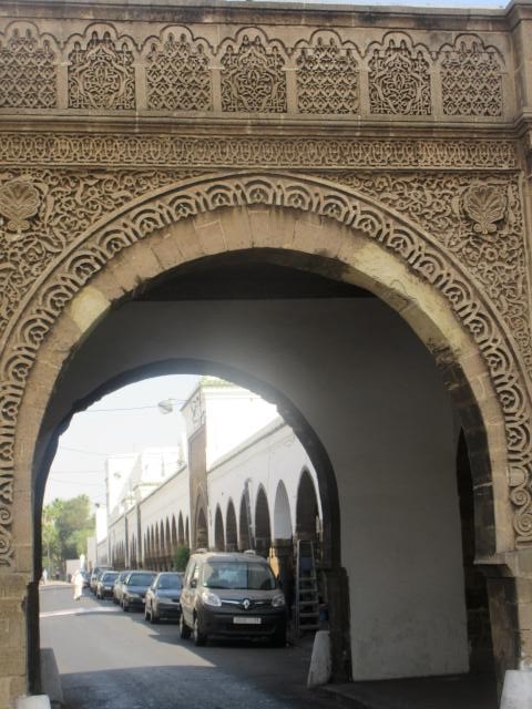
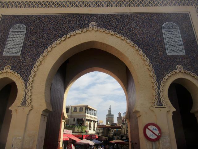
Every medina is surrounded by a wall, punctured by various decorated gates.
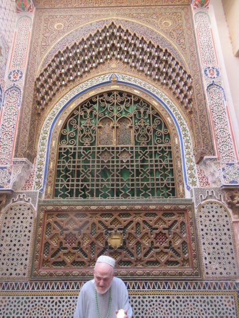
So many fancy buildings here. Below is the oldest university in the world. Previously they taught all subjects, but now just the Koran. Having said that, we were impressed that Morocco is not fanatical about their Islam. In fact, they were eager to tell us how they are different from the ‘crazy’ people of the more eastern countries. Even so, entry to most mosques is closed to non-muslims.


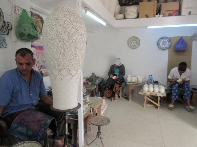
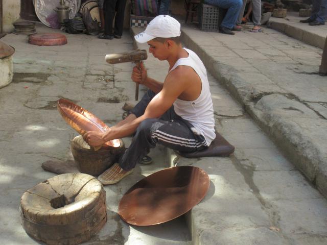
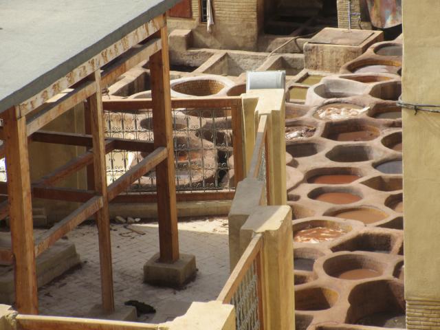
The smells, or stink, is mostly provided by the tanneries that soak the skins in solutions of pigeon poop. Yet, somehow the leather comes out without any smell at all. But don’t worry, they give you a sprig of mint to shove up your nostrils.

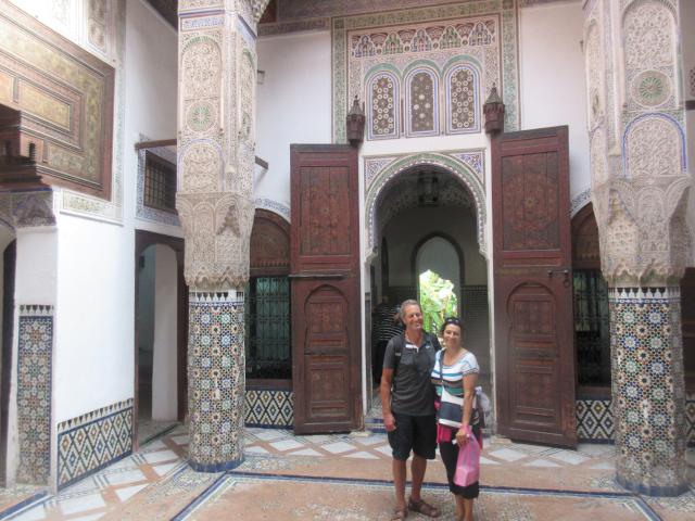
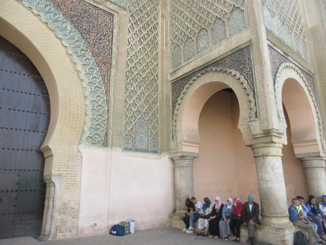
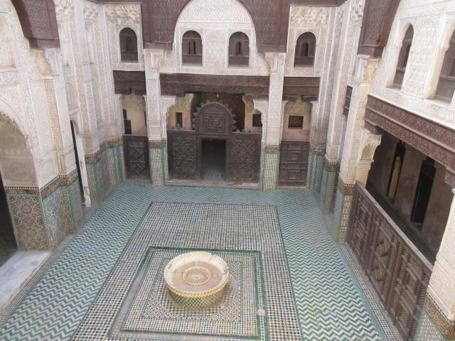
Meknes
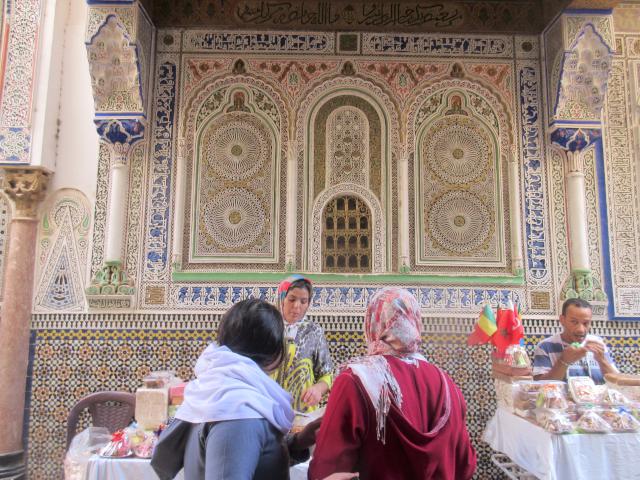
Yet another world heritage site with several impressively tiled buildings all quite close to each other. We were able to see these during a few hours on our way from Fez back to Rabat. Below is Dar Jamai museum. Dar just means ‘house’, so this was a large house which previously housed a rich man and his harem, plus various other relatives.
This was, again, one of the gates to the medina, at the main square Place Hedim.
Another Koranic school (Madrasa) dating back to 1350. Upstairs were numerous small bedrooms for the students.
Below the city was Habs Qara prison, which housed as many as 60,000 prisoners chained to the walls. They were used to build the palaces during the day.

There is, of course, so much more that one could say, but then it would all be ‘Too Long, Didn’t Read’ (TLDR) 🙂
And, of course, pictures don’t capture the full experience.
And so, back to Rabat, and then a sail to the Canary Islands.
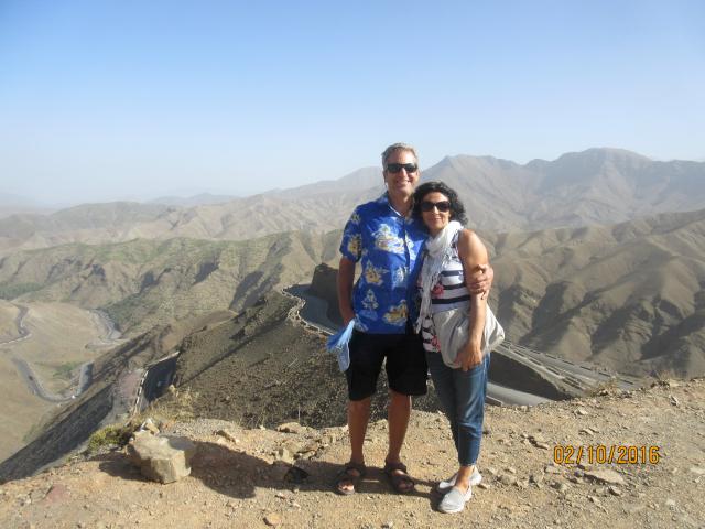
We are now at the bottom of Lanzarote, enjoying the sun and the warm sea. Great swimming, clear water – even saw a giant ray.
A 500 Mile Beat?!
Current Position: 28 57.7 N 013 32.38 W Click to view map.
Distance sailed since last post: 459 nautical miles. View the map of our voyage track here
A 500 Mile Beat!?
Well, that was definitely not what signed up for. We left Rabat with a forecast that gave us favourable downwind sailing until the final day when it would be a close fetch for the final stretch. We have no means of getting a forecast en route, so we had to rely on that forecast for the full passage. But being only three days, that is usually pretty reliable.
And what did we get?
First, instead of 10kts behind us we had a flat calm for the first day. Or, if it wasn’t flat calm, it was 5 kts on the nose. Right from the start the forecast was completely wrong. We left Rabat at 10am on Monday morning and ended up motoring at a leisurely 4kts for most of the first TWO days – finally killing it just before midnight on Tuesday. But at least the sea was calm and the sun was shining. A few times the wind picked up and we could sail for a few hours, and then it would disappear again, and the motor would be back on.
But there were compensations. On Monday night there were some dolphins swimming alongside. That was really cool, as you could see the phosphorescent trail they left behind as they swam back and forth under the boat.
At lunchtime on Tuesday there was a huge whale right behind us. Too close, in fact, as he snagged our fishing line, and so that was the first of our lures gone. I think we are going to have to keep a tally of the fish to lures lost ratio. I am not sure which is winning at the moment. Still, it was fun to watch him – and then he breached! Jumped right up into the air and landed on his back! Wow. Actually, as whales go, he was quite small – maybe the size of our boat – but that is still pretty big. No photos, sorry!
Shortly after that we caught two Mahi Mahi, which we grilled on the barbecue that evening, thank you very much! See, that shows how calm it was, that we could be grilling.
Then, instead of a nice broad reach, with wind from the NW, we had variable winds of 10-15kts from the south to south west! So instead of reaching, we were now beating, bashing into 2m waves, and not laying our destination. Which meant putting in several tacks, thus increasing the distance sailed by at least 25 miles, and making for uncomfortable bouncy nights trying to sleep. Life Part 2 does NOT do well in those conditions. Closehauled we need a good 15kts, preferably more, to get going. Below that we wallow along at maybe 3kts and with lousy tacking angles which means that we make almost not progress to our destination.
Along the way the wind did some crazy stuff and in the middle of some multiple (unintended) tacks, we lost the second lure.
By Wednesday morning the wind started to pick up, though still from the SW. The (old) forecast still said it was supposed to be from the NW. We put in a few more tacks, but now were sailing better at 5-6kts with two reefs in and winds of up to 25kts.
Then we had squalls. Wind gusting to almost 40kts, spray and rain. In the middle of the night, of course. I was glad we were down to the second reef, but at least now we were doing 7 to 8 kts, though still not quite in the right direction. We were trying to work our way to the west, in the hopes that at some point the forecast wind of a westerly would come in, and we could then get a lift to the destination. That did finally happen on Thursday morning. We were supposed to be arriving that day, but were still almost 200 miles away!
Finally at lunchtime on Thursday the wind freed off. We had managed to work our way west, and so we now did have a beam reach down to the Canaries. The waves were still well over 2 meters, but that is much less of a concern when going downwind. The wind was up to 18-19kts, so we were zooming along at 8kts – double what we had for the first two days. THIS is what he had signed up for!
At 8am on Friday we had sight of land! A day late, but we would soon be arriving in Lanzarote with a nice beam reach on a sunny day.
Then we caught two more fish… but they both got away. bummer.
By 2pm we were tied up in the Marina Lanzarote at Arricefe. In the end we sailed just about 500 miles, instead of the planned 475, and took 100 hours instead of the hoped for 75 hours. Average speed was thus 5 kts in the end.
Now we have to go an explore…
Leaving for Canaries Tomorrow
After a whirlwind tour of Morocco, which we have really enjoyed, we are now ready to leave. We will put together the photos and blog in due course, but right now the forecast says go tomorrow – or wait another week. So, once again, it ends up with a bit of a rapid departure. We would have preferred to stay another day or two, but that’s how the wind goes.
The trip will be about 470 miles, and should have some nice fast downwind stretches again. So we hope to arrive sometime on Thursday, assuming an average speed between 6 and 7 knots.
We are aiming for Arrecife, on Lanzarote. Once we are there we will sort all that internet stuff again, and then will be back in touch. In the meantime, we will be off the grid for a few days.
Have fun in the meantime!
180 Miles in 24 hours
Current Position: 34 1.8 N 006 49.35 W Click to view map.
Distance sailed since last post: 298 nautical miles. View the map of our voyage track here
Wow, what a sail! With about 20 kts (true) of wind behind us, we set off from Lisbon with an average speed of 7.7kts. Far faster than our original anticipation, including one 24 hour stretch in which we covered over 180 miles which, I think, is a personal best.
For the first 50 miles we sailed on a broad reach on starboard with 2 reefs in the main and a full jib. This was taking us off to starboard of our course, but giving us some great speed. Then we bore off a bit, and ran almost dead downwind with the jib out to starboard and the main out to port – sailing wing-on-wing as the Yanks call it or ‘goose-winged’ as the Brits would say. By keeping about 10 – 20 degrees to starboard of a dead run we avoid the risk of an accidental gybe – and we also have a gybe preventer rigged, just in case.
The wind varied from about 10kts apparent to 25kts apparent. And the 2.5 meter waves also threw us around a far bit. At times we were surfing down the waves with speeds as high as 16kts. At other times we were down to 6kts. Our average for this stretch, though, was well up at 8kts. Exhilarating sailing!
You will note that I talk about true and apparent with regard to the wind. Imagine you are on a bicycle on a calm day. As you pedal along, you feel a breeze on your face. Turn around and you still have a breeze on your face. That is your apparent wind, caused by your own forward motion. Now imagine it is a windy day, and you set off on your bike with the wind on your back. As you pedal more quickly, you notice the wind feels less. Go fast enough and the wind might now even be on your face. In this case, the wind you feel (your apparent wind) is the combination of your forward motion plus the real true wind. Thus the apparent wind might be more or less than the true wind, and it also may come from a different direction. But what we feel, and we can measure, on a boat is only the apparent wind. To find the true wind we have to do a bit of math. So mostly we talk about the apparent wind.
There is a lot of big ship traffic down this coast, so we have been dodging them. So nice to have the AIS to tell us who we are (not) going to hit, and by how much we will miss them. Because there is so much commercial traffic rounding the cape on their travels between northern Europe and the Med, there is a Traffic Separation Scheme. Essentially this is like a two-way highway mapped out on the sea. The charts clearly show which lane you should be in, depending on your direction and your cargo. The outer lanes are for dangerous goods, and the inner lanes for other traffic. One ‘drives’ on the right so, going around Cape St. Vincent, the inner lanes are headed west and north and the outer lanes are for south and east.
Originally our course took us close to Cap St. Vincent, inside of the traffic separation zone. But that meant we were dodging a lot of ships for a long time. So I decided to alter our course farther to the west, so as to sail along the correct lane of the traffic separation zone. This added about 18 miles to our overall distance, but at this speed that doesn’t seem to be a huge consideration, and it means I din’t have to wake Ceu up from her snooze to do an early gybe.
On the image below you can clearly see the Traffic Separation Zone as it is marked on the chart, and also our track, in green, passing through it. The black dashed diamonds with a cross in the middle and a cross at the top are virtual buoys. These are created from AIS signals that are transmitted from local shore stations. The signals are similar to those of ships, but in this case they indicate a virtual position, not a physical one. There are no actual buoys floating around in the TSS, just these virtual ones. There are actually several more of them, clearly marking out the traffic lanes, but the screenshot was taken when we were 100 miles farther south, so we were not receiving all of the signals fully.
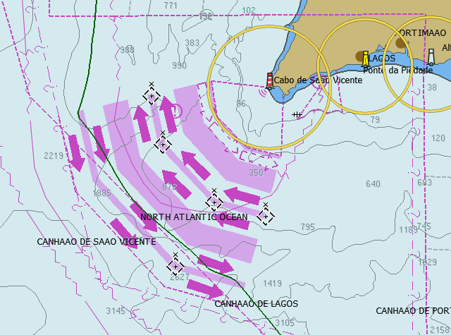
Traffic separation zone
The sky was fantastic. It was a totally clear night, with the Milky Way very visible. The moon is crescent waning, and only rose at about 3 am, so before that it was really dark. So many stars!
By 7am we were passing Cap St. Vincent. About 100 miles done, another 200 to go. Well ahead of schedule. Unfortunately we were too far out to sea to get a cell phone connection here, so no more connections, or updates, until we reach Rabat.
The traffic separation scheme wound its way around Cap St. Vincent, and we finally came out of that by noon. At this point the wind died down a bit, as did our speed. We shook out the reefs and went to full sail on a broad reach on port, having gybed at the beginning of the Traffic Separation Scheme. You can see the sudden course change on our track in the image above.
The wind stayed low through the afternoon, around 9-12kt apparent, and soon we were back to wing on wing, but on port tack this time. But as evening came on, with a beautiful sunset, the wind picked up again to 15-18kt. We put in a single reef for the night and our speed is back up at 7kts or so.
For a while we were worried that we were going too slowly and would arrive at Rabat in the dark, but the wind held up through the night, maintaining our speed at above 6kts throughout.
By morning the wind had veered (moved clockwise), so now we were on a close fetch but still laying the destination. The wind was down, so we shook out the reef, hauled in the sails, and still maintained the necessary 6+ kt average. At this point we were in the position shown on the chartlet below.
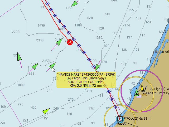
Arriving at Rabat, Morocco
On the image, we are the red blob. The red line with the blue diamonds is our theoretical fastest course that was plotted out by a weather routing plugin. What it does is take the weather forecast (provided in a gridded binary – GRIB – format), combines that with the theoretical speed of the boat on different courses and in different wind strengths, and calculates the fasted route from A to B. In this case it predicts we should arrive in Rabat at about 4pm.
The green triangles are other ships, as plotted on the chart by AIS. By hovering over one of them you can see that Navios Mars is travelling (speed over ground) at 11kts and will pass by us at a minimum distance (closest point of approach) of 5.6 nautical miles in 72 minutes time. So we don’t need to worry too much about him, unless his or our speed changes dramatically. If it looks like he will pass by closer than 2 miles, the chart will sound a loud alarm to warn us. The ship to the bottom left, in lime green, is that color as we are not receiving full information on him. There is also a ship at anchor (shown by the single black ball on it) in the river at Kenitra. Clever stuff, eh?
A couple of hours later the wind had freed off again, and so the sails were also let out farther. A cloudy start to the day, but noticeably warmer than the previous day. Still maintaining our 6kt average, though it was looking a bit dicey at one point, especially when the wind dropped right down and the fog closed in. So on went our new fog horn – long and two shorts for a sailboat – and on went our radar. We were starting to get into the Moroccan fishing areas, so we didn’t want to run into some small unmarked fishing vessel.
At 1:30pm the sun broke through, the fog dispersed, and the wind dropped right down. We needed some more speed. So up goes the spinnaker and instantly we have another knot and a half. Back to above 6kts – indeed, creaming along at 7kts much of the time as the wind did pick up again. We can still make it in time for tea (and before dark, more importantly).
But then tragedy strikes! I go to check the fishing lines and discover that one entire rig has disappeared. On it were the yellow handle on which the line gets coiled, a diving planer, and a huntington drone. All of these were attached to the boat with a heavy duty piece of string, just like the other handline as seen below.

Our intact fishing gear
Except in this case the entire lot is gone. The string tying it all to the boat was severed just inches away from its attachment, as you can see on the second photo.
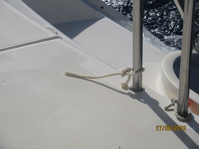
All that is left is a few inches of string. What the heck?
There are no rough edges anywhere near there. It looks like it was cut through. But how on Earth could that happen? Did Neptune sneak onboard and cut away our fishing gear? We have not yet crossed the Equator, so I don’t see how we might have offended him. There were many weaker links farther down the line that should break first if there was any heavy load on it, so how could the line part way up here? This is a totally mystery, and very frustrating to lose all that gear. And we still didn’t catch anything on the other lines.
But still, we had a glorious sail with everything from a good fast blow, to brief light winds and then a fantastic spinnaker reach in glorious sun for the final 4 hours.
We arrived in Rabat just as the wind was fading. We motored the last 4 miles and followed the pilot boat in through some big, but not breaking, wwaves. At the reception dock we were med by four customs and immigration people, plus one dog. They all came aboard and were very friendly. We filled in a bunch of forms and the dog had a good sniff around. Their English was reasonable. We were then take around to our dock in the marina where four marineiros took our lines and helped us to tie up. All very helpful and friendly. Then we went of a lovely shower with a huge ‘rain’ shower head. A very pleasant introduction to Morocco.
This morning we met with some of the 7 Dutch boats here, and also a Canadian from Montreal. There is one other singlehanded Canadian who, apparently, has been round the world twice by himself in his small monohull. We have also be drying out the bedding from the port bed as we discovered that the hatch cover, though closed, was not locked, and so some of this big waves dumped themselves right onto the bed. Not so good. But by now they are actually already rinsed and almost dry.
Today the wind has set in from the East already, and it is bringing some Saharan dust with it. I am glad we did our crossing then.
Tomorrow we go exploring. Most likely we will go and spend a few days in Marrakech.
Will keep you informed!
On Our Way to Morocco
There is a gale about to blow easterly from the Gibraltar strait. That would make for an unpleasant crossing. And after that the winds are rather confused, for at least the coming week.
So, we could sail down to the Algarve and wait for a week.
Or we could go now. If we go now, we should be in Morocco before the blow sets in, and that gains us an extra week in Morocco. So that is what we are doing. Right at this moment we are exiting the Tejo River, and soon we will be flying downwind with an estimated journey time of 2 days and 11 hours to cover 315 miles or so. Of course that is all a guess.
But in any case we hope to be in Rabat, Morocco sometime on Tuesday, at which point we will try and connect up with email etc.
So, until then, have fun!
Ready to Take off – and a New Destination?
Current Position: 38 38.64 N 009 6.47 W Click to view map.
Distance sailed since last post: 15 nautical miles. View the map of our voyage track here
We are now back in Seixal, Portugal, having had a month in Canada to welcome Allisen’s new baby boy, Behnam – grandson number 3! It was a good and busy time, as I also used the opportunity to do some more renovations on one of our rental properties.
So now, after another quick visit to Casegas to see Ceu’s mom and wish her brother Joachim a happy birthday, we will be ready to take off on our new adventures.
The plan, originally, was to head to Madeira. But seeing the winds and the distances, we are thinking that we can also fit in a quick visit to Morocco first. So that would mean scooting down the west coast of Portugal back to the Algarve. Then a two-night crossing south east to Morocco and then, after that, a 4 night crossing east to Madeira. Or we might miss out Madeira totally, since it was burnt down by all those fires, and that would give us additional time for visiting Morocco.
After that we then resume our original plan of heading south to the Canaries, Senegal, Gambia, Cabo Verde and West to Barbados. For all of these trips we should have favourable winds – somewhere between a beam reach and a run, though the waves may make things a bit more lively than we were used to in the Mediterranean.
Over the last year we have not done a lot of sailing! In fact, I think we have been afloat for probably only two months in the last year. But next year will make up for that, as we shall be visiting by boat three different continents (Europe, Africa and North America) and crossing one ocean. And, hopefully, catching lots of fish!
We will keep you informed as we progress.